Gualaco
Gualaco is a municipality in the north of the Honduran department of Olancho, west of San Esteban, north of Santa Maria del Real and east of Guata.
Gualaco is served by Jicalapa Airport, a grass airstrip 3 km southeast of town.
At the time of the 2013 Honduras census, Gualaco municipality had a population of 21,863. Of these, 97.11% were Mestizo, 1.76% White, 0.56% Indigenous, 0.50% Black or Afro-Honduran and 0.07% others.
Gualaco is served by Jicalapa Airport, a grass airstrip 3 km southeast of town.
At the time of the 2013 Honduras census, Gualaco municipality had a population of 21,863. Of these, 97.11% were Mestizo, 1.76% White, 0.56% Indigenous, 0.50% Black or Afro-Honduran and 0.07% others.
Map - Gualaco
Map
Country - Honduras
 |
 |
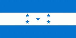
| Flag of Honduras | |
Honduras was home to several important Mesoamerican cultures, most notably the Maya, before the Spanish colonization in the sixteenth century. The Spanish introduced Catholicism and the now predominant Spanish language, along with numerous customs that have blended with the indigenous culture. Honduras became independent in 1821 and has since been a republic, although it has consistently endured much social strife and political instability, and remains one of the poorest countries in the Western Hemisphere. In 1960, the northern part of what was the Mosquito Coast was transferred from Nicaragua to Honduras by the International Court of Justice.
Currency / Language
| ISO | Currency | Symbol | Significant figures |
|---|---|---|---|
| HNL | Honduran lempira | L | 2 |
| ISO | Language |
|---|---|
| ES | Spanish language |


